| Texte | The “Southern Great Wall” is viewed as one of the “three tourist treasures” in Fenghuang County (the other two being the ancient fortified towns of Fenghuang鳳凰古城 and Huangsiqiao黄絲橋古城). Its discovery, however, was made by chance.
At the turn of the 21st-Century, the Fenghuang County government drew up a strategy of “promoting tourism” as the lead for local economic development. Indeed, a region where the Miao 苗people have lived in compact communities and where political, military, economic, and cultural interactions among different ethnic groups have taken place in China’s long history, Fenghuang is rich in tourist resources, including diverse ethnic cultures (e.g., Miao, Tujia, and Han), historical sites (e.g., the ancient town of Fenghuang), famous figures (e.g., Xiong Xiling熊希齡 and Shen Congwen沈從文), and natural landscape (e.g., Tianxingshan Mountain天星山, Nanhuashan Mountain南華山, and Qiliangdong Cave奇梁洞). In late April 2000, in order to prepare the application for the title of “national famous historical and cultural city” (Guojia lishi wenhua mingcheng 國家歷史文化名城), and thus to inspect and appraise Fenghuang’s historic sites, the County government invited two authorities on cultural heritage from Beijing—Zhao Jinghui赵景慧 from the Ministry of Construction建設部, and Luo Zhewen羅哲文, the head of the Group of Experts on Ancient Architecture for the State Administration of Cultural Heritage國家文物局, president of the China Cultural Heritage Academy, and honorary director of the Great Wall Society. The government took the inspecting tours so seriously that its top-ranking officials (the secretary and one deputy secretary of the Communist Party Committee and the magistrate and one deputy magistrate of the County People’s Government) accompanied the two specialists during the three-day trip.
On April 22, 2000, having visited the ancient town of Huangsiqiao黄絲橋, an important stronghold in imperial times since the Tang dynasty, the group set out back to the county seat Tuojiangzhen沱江鎮. En route, while passing by Yongxingping永興坪 Village, the director of Fenghuang Administrative Office for Cultural Heritage 鳳凰文物管理所Chen Qigui陳啓貴pointed to some dilapidated walls on the roadside Yingpanling Hill营盘岭at Yongxingping Village 永興坪and told the guests from Beijing: “That is the site of the frontier wall against the Miao territory [Miaojiang bianqiang 苗疆邊牆].” “Frontier wall?!” The name excited Luo Zhewen, who had studied the Great Wall for over fifty years. Long ago Luo found in the Hunan tongzhi 湖南通志 (General gazetteer of Hunan) that a “Great Wall” existed in Hunan, but had never been able to locate it. In imperial times, the Great Wall along the northern frontiers was also called “bianqiang” (frontier wall). Was there any connection, Luo wondered, between these two pieces of work? Upon his request, the inspecting group revised their itinerary, and climbed up the hill to take a closer look.
What Luo saw on the hill astonished him. Halfway up the hill was a ruined military fortress, called Quanshengying 全勝營or Quangshiying全石營 (lit., all-victorious fortress or all-stone fortress). It consists of a two-storied blockhouse, the fortress wall (Fig. 4), various rooms (for officers, soldiers, and prisoners) (Fig. 5), a Temple of City God, a drill ground, and the east and west gates. The blockhouse, which becomes the symbol of the “Southern Great Wall” now, is over six meters high, and 11 square meters at the base (Fig. 6).[3] It opens a door on the north side,[4] and has loopholes on other three sides (Fig. 7). A two hundred meter long road traverses the whole fortress, which covers an area of 7500 square meters. It is estimated that about 700 troops stationed in this fortress. A fortress wall of over 300 meters is well preserved. It is about five meters in height, with a pavement of one meter wide and embattlements of 0.5 meter high on the top. The garrison wall stretches up to the top of the hill, connecting the frontier wall. The frontier wall, like the fortress, was built with local flagstones. The remains of the wall stretch for about one hundred and fifty meters long. It is connected by two blockhouses on other two hills. Having carefully examined the construction materials and style, Luo declared with great joy: “This is wonderful: This is the Southern Great Wall of the Ming dynasty! I never expected that after searching for the sites of the Southern Great Wall for fifty years, I found it here! This is indeed a miracle! This fulfilled my fifty-year-old wish!”[5]
On August 17, 2009, I visited Mr. Luo Zhewen at his home in Beijing, and consulted him on why he called the “frontier wall against the Miao territory” the “Great Wall” (changcheng長城). He held that three elements determined if a wall could be defined as “Great Wall.” First, its length: it should stretch at least one hundred kilometers, typically two to three kilometers. Second, its structure: it should be open but not join up to form a sealed enclosure. A city wall is closed construction; it thus could not be called “Great Wall” no matter how long it is. And third, its components: a “Great Wall” could not just consist of one single wall; it had to be a complex system, including the wall, passes, blockhouses, beacon towers, and garrisons, etc. Judged upon these criteria, the “frontier wall” in west Hunan was worthy of the name of “Great Wall.” More importantly, Luo viewed the “frontier wall” in west Hunan an integral part of the Great Wall project in the entire imperial realm. The study of the Great Wall in the north, therefore, shall not overlook the pieces in the south. Indeed, in his recent book Changcheng (Great wall), Luo introduces the “frontier wall in west Hunan (Southern Great Wall)” to his readers. In essence, he argues, the defense system centered at Fenghuang that featured the “Southern Great Wall” and its auxiliary facilities served as the tenth military command of the Ming dynasty (Fib. 8).[6]
Luo’s discovery and affirmation of the “Southern Great Wall” caused a great sensation in Fenghuang County, in Xiangxi Prefecture, and in whole Hunan Province! All the three levels of government considered this as a key factor in promoting local culture and economy and appropriated funds to conduct further surveys of the wall and its affiliated facilities. Guided by the provincial Cultural Heritage Bureau省文物局, Xiangxi Cultural Heritage Administrative Division 湘西州文物管理処organized two survey teams headed by its deputy head Long Jingsha龍京沙, consisting of thirteen people from various working units.[7] From May 17 through July 11, 2000, these two teams spent 55 days conducting fieldwork. After traveling nearly 800 kilometers and interviewing 961people-times, they discovered 85 remains of the “Ming-Qing frontier wall against the Miao territory at Xiangxi湘西明清苗疆邊牆,” amounting to 13,185 meters long. Overall, they affirmed 190 kilometers long of Wall, running mostly from southwest to northeast in Fenghuang County.[8]
Since then, Xiangxi Prefecture organized some more surveys. By June 2009, according to Fu Qunzhi (Fig. 9), about forty new sites of the “Southern Great Wall” have been found in Fenghuang and its northern neighboring administrative units of Jishou 吉首City, and Huayuan花垣, Baojing保靖, and Yongshun 永順counties.[9] According to Luo Zhewen, the newly discovered remains add over 300 kilometers to the “Southern Great Wall” discovered in 2000.[10]
Meanwhile, the discovery of the “Southern Great Wall” at Fenghuang made a stir in the neighboring city of Tongren 銅仁, Guizhou Province. Although some scholars and officials had been aware of the “frontier wall” for decades, it was after May 2000 when they started to survey it in terms of “Southern Great Wall” and assess its cultural and tourist values. Between 2001 and 2003, Tongren Prefectural government spent some 600,000 RMB to restore and maintain the Baoziying 豹子營section of the wall (Fig. 10). After several years of surveys and research, in October 2004, the Guizhou Society for Miao Studies organized a conference at Tongren Prefecture (which has become Tongren City since 2011) on tourism at Fanqingshan梵净山 Mountain, the Fortified Town of the Miao King (Miaowang cheng苗王城) at Xinzhai新寨, and the “Southern Great Wall.”[11] In August 2009, I visited the Fortified Town of the Miao King, and on June 24, 2010, I interviewed Mr. Wu Guoyu吳國瑜, the Miao scholar and division head at the Ethnic and Religious Affairs Committee of Tongren Prefecture銅仁地區民族和宗教事務委員會. Mr. Wu holds that the “Southern Great Wall” in Songtao should be as long as 240 kilometers.[12] The village named Bianqiangzhai邊牆寨 (lit., the village of frontier wall) at Zhengdaxiang Township 正大鄉of Songtao testifies the existence of the “Southern Great Wall” in the east end of Guizhou.[13] (Fig. 11)
The Wall
The “Southern Great Wall” was a product of imperial ethnic policy during Ming and Qing times. It was initially constructed during the Ming dynasty so as to contain the “raw Miao” (shengmiao生苗, i.e., the “unassimilated” Miao from the imperial point of view) in the “Miao territory” at west Hunan and east Guizhou, hence the “frontier wall against the Miao territory” (Fig. 12).
The “Miao territory” during the Ming covered present-day Fenghuang, Jishou, Huayuan, Guzhang, Baojing at west Hunan, and Songtao at east Guizhou (Fig. 13). The Ming government divided the Miao in this area into two kinds: the “cooked” and the “raw.” The “cooked Miao” (shoumiao 熟苗, i.e., the assimilated Miao as the imperial court saw them) lived with or close to the Han, and adopted some Han cultural traits. The “raw Miao,” however, were free from the control of Han officials or other ethnic groups and retained their own beliefs and practices. Their distinct lifestyle and autonomous societal systems were shaped and preserved in part by the physical terrain of their homeland. Centered at Laershan Platform 臘爾山臺地in west Huguang,[14] the territory of the “raw” Miao featured rugged mountains, which was hard for outsiders to penetrate (Fig. 14). During my visit, for instance, I found that a lot of Miao people at Jixinzhen Town吉信鎮 (a “cooked Miao” area known as Deshengyin得勝營during the Ming dynasty) could speak and write Han language (Fig. 15), which is not the case in the mountain areas. Zhang Renzhong張任重, the former head of the County Bureau of Communications 交通局and current head of County Bureau of Development and Reform發展與改革局, informed me that until the 1990s, much of the Miao area in the mountains had not been connected by highways. Since then, the government has made greater efforts to build new road networks (Fig. 16). When I toured the Miao area in recent years, I did find that the road conditions have improved tremendously (Fig. 17). On the other hand, however, I also noticed that a number of villages were still not connected with basic paved pathways. Local people wished that the progress should have been made faster and greater. Indeed, in 1990, when Zheng Peimin 鄭培民 (1943-2002) took the office of CCP Secretary of the Xiangxi Prefecture and choose Huoluping火爐坪 Village at Fenghuang as his “poverty-relieving spot” 扶貧點, one of the first things he wanted to help was to seek some funds to construct a “village-level highway” 村級公路from Huoluping to Hekuzhen Town禾庫, some 14 kilometers northwest of Huoluping, so as to connect the local people to the “outside world.” The road-construction project could not start until 1997, after Zheng had already become the vice governor of Hunan Province, and was only completed in 2001. During the Ming and Qing, the “Miao territory” had a circumference of about 1000 kilometers, with an estimated population ranged from 100,000 to 150,000.[15]
The “frontier wall” marked roughly the boundary line between the “cooked” and the “raw” Miao people. It was built as the Ming efforts to seal off the “raw” Miao territory more effectively. In 1533, Sun Xian 孫賢, the Assistant Regional Commander at Chenzhou 辰州 (present-day Yuanling沅陵), constructed the first known “frontier wall.” From Qiliangqiao奇梁橋of Wuzhaisi 五寨司 (present-day Fenghuang鳳凰) to Qianzhou 乾州 (in present-day Jishou吉首), it stretched for about 35 kilometers, four meters in height and about 1.6 meters wide at the base. Along the wall, over ten sentry posts (shao 哨) were built to guard against the west side of the Miao territory.[16]
During the Wanli reign (1573-1620), a longer frontier wall was constructed under the Administration Vice Commissioner (canzheng 參政) of Huguang Cai Fuyi 蔡復一 (1576-1625). Most of the wall was made of earth, with roughly 2.7 meters in height, with 1.7 meters in width at the base, and one meter in width at the top. Parts of it also consisted of natural mountain peaks or cliffs.[17] During the Tianqi reign (1621-27), the Vice Commissioner of Chen-Yuan Military Defense Circuit (Bingbei dao fushi 辰沅兵僃道副使) Hu Yihong 胡一鴻assigned officer Deng Zuyu鄧祖禹 to expand the frontier wall from Zhenxi to Xiqueying 喜雀營 (some 15 kilometers north of Zhengxi), making it a 190-kilometer-long wall. By the end of the Ming, however, when rebellions took place across the empire, the local “raw Miao” also revolted and destroyed the wall.[18]
During the Qing Dynasty, although the Manchu government made considerable efforts to incorporate the Miao territory to the imperial administration, they continued to contain the “raw” Miao with military facilities. By 1805, under the command of Fu Nai 傅鼐 (1758-1811), the magistrate of Fenghuang Subprefecture鳳凰廳同知, a stone wall of over 50 kilometers was built between Silukou 四路口of Fenghuang and Mulinping 木林坪of Qianzhou乾州.[19] (Fig. 18)
According to the official report of the Cultural Heritage Administration Division of Xiangxi Autonomous Subprefecture 湘西自治州文物管理処,[20] the frontier wall starts at Tingziguan Village亭子關of Huanghe Township黄合鄉, Fenghuang County, at the intersection of 109 degree and 20 minute of east longitude and 27 degree and 49 minute of north latitude. It first stretches north, then turns east at Luochaojing落潮井, goes north again at Yingpan營盘, turns east again at Yabaodong鴉保洞, and finally turns north at Changchongying長冲營. It ends at Xiqueying喜鵲營of Tuanjie Village團結村of Majing’ao Township馬頸坳鄉, Jishou City, an intersection of 10 degree and 49 minute of east longitude and 28 degree and 26 minute of north latitude. The elevation of the places where the frontier wall stretches ranges from 100 to 800 meters (Fig. 19).
In addition to the wall itself, other fortifications constituted integral parts of the “Southern Great Wall.” Based on their fieldwork in the summer of 2000, the government-sponsored investigation teams discovered the following relevant sites:[21]
Military towns, 3: Fenghuang, Qianzhou, and Weicheng 衛城 (at present-day Huayuan County花垣縣). Of the three, Fenghuang 鳳凰古城was the most important commanding center. In ancient times, Fenghuang was part of the “wuxi Miaoman 五溪苗蠻” (Miao barbarians along the five rivers) region in the eyes of the imperial government. In the early Ming, known as Zhengan鎭筸, it was the seat of Wuzhai zhangguansi五寨長官司, protected by an earthen city wall. In the 1550s, after the office of assistant regional commander was moved here from Mayang County麻陽縣, the city wall was rebuilt with bricks. During the Kangxi reign (1662-1722) of the Qing dynasty, Fenghuang was promoted to the status of subprefecture (ting 廳); its brick city wall was replaced by a stone wall with a circumference of two kilometers. Throughout history, Fenghuang has served as a pivotal point for the interaction of various ethnic groups in the border areas of present-day Hunan, Sichuan/Chongqing, and Guizhou, especially between Han and Miao peoples. With its distinct cultural and natural traits, in 2001the ancient town of Fenghuang was selected as one of the “national famous historical and cultural cities” (國家歷史文化名城) (Fig. 20). In 2008, it was added to the UNESCO World Heritage Tentative List (世界遺產名錄預備名單) in the cultural category.[22]
Garrisons (chengbao 城堡 or xunba 汛堡), 10. Garrisons were usually located at strategic areas, coordinating military affairs of the region. They were all protected by stone walls, which had two to four gates and were equipped with cannon emplacements on top. Shaped in round or square, these garrisons ranged from 5,000 to 20,000 square meters. Inside the facilities, civilian residence areas and military sectors were designated, and administrative offices and ammunitions depots were established. The most famous of such garrisons is Huangsiqiao 黄絲橋, some 25 kilometers west of Fenghuang county seat Tuojiangzhen Town沱江鎮. In the Ming, it was surrounded by an earthen wall, which was replaced with stones during the Kangxi reign of the Qing. The wall was 602 meters in circumference, equipped with three cannons and built with over 300 embrasures. The town had three gates, on the east, west, and north sides respectively. No gate was built on the south side because the townspeople believed that south belonged to the element of “fire” and feared that if a gate was built on the south side it would lead fire into the town. Inside the town, the offices of brigade vice commander (dusi都司) and police forces (xunjian巡檢) were established. Located near the border to Guizhou, it functioned as a “throat” on the Hunan-Guizhou-Yunnan passageway. Originated in 687 during the Tang dynasty, Huangsiqiao is said to be one of the best preserved ancient towns in China. In 2006, it was listed as the “national cultural heritage preservation unit” (國家級文物保护單位) (Fig. 21). Other garrisons include Tingziguan 亭子關and Xiqueying喜鵲營, the southern and northern ends of the frontier wall.
Forts (tunbao屯堡), 130. Smaller than garrisons, forts consisted of two types. The first was to provide temporary residence for civilians and their livestock from nearby villages (e.g., Wangpotun 王坡屯 at Huanghexiang黃合鄉); the other was exclusively built for troops (e.g., Tengshujing tunbao腾樹井屯堡 at Jixinzhen 吉信鎮). Mostly constructed on hills, these fortifications could readily provide military support to other places, including the frontier wall. Wangpotun was built on the top of Huangtupo, with a circumference of 360 meters. Its interior surface was about 2.7 meters high, and its exterior surface was as high as 6 meter (Fig. 22). Tengshujing was only one kilometer away from Deshengying 得勝營(present-day Jixinzhen) in the north and 500 meters from Gaoloushao Post髙樓哨in the south. Its stone wall was 2 meters wide at the base and its battlements were 0.8 meters thick. Along this 1500 meter-long defensive line, six stone blockhouses were built, which were then connected by the frontier wall. All of these facilities constituted an effective military network.
Sentry barracks (shaoka 哨卡), 47. These barracks covered an area from 300 to 5,000 square meters, depending on the significance and landscape of the location. Their residence could range from 20 to 70 households. They were all equipped with cannons, which were put in the formation of either “品,” “一,” or “*.”
Blockhouses (diaoka碉樓), 311. Built for both offensive and defensive purposes, the blockhouses were located either inside or outside the frontier wall. They also functioned as watchtowers and beacon towers. Each blockhouse was usually structured with two or three stories, up to 24 loopholes, and about 5.3 meters wide on each side at the base and 4.7 meters on the top. The distance between the blockhouses could range between 50 to 200 meters.
Pass gates (guanmen 關門), 39. Most of the gates were built along the frontier wall, guarding the strategic positions, such as Laerguan 臘爾關 (Fig. 23) and Jingbianguan靖邊關.
Camp-villages (yingpan zhai 營盘寨), 4: Shujiatang舒家塘, Linzhai林寨, Badouqiu八斗丘, and Lahao yingpan拉毫營盘. Combining military camps and civilian villages, these camp-villages were protected by impressive walls. The wall of Shujiatang, for example, was 1500 meters in circumference, six to eight meters high, and two meters thick. It had three gates on the sides of east, west, and north; the east gate was three meters wide and 2.7 meters high. Inside the wall, not only the streets but also many houses are built with blue flagstones. The whole community becomes a fortified facility (Fig. 24). Lahao yingpan was all built with stones. Among its current 200 odd households, there are more than 50 surnames, which indicates its military heritage (Fig. 25).
The frontier wall and other fortifications formed a military barrier circle in west Huguang and east Guizhou of the Ming empire. Inside the circle were the “raw” Miao centered at the Laershan Mountain. The wall made it difficult for the interaction and exchanges between the Miao territory and the areas dominated by Han culture. To certain extent, the wall also played a role in preserving Miao culture. Indeed, even at the present, Miao customary law and other institutions are also frequently used in people’s daily life (Fig. 26).
The Restoration
The “Southern Great Wall” has been severely damaged over the past several centuries. The Ming earthen wall was destroyed by Miao people at the end of the Ming dynasty. The Qing stone wall was gravely damaged as well, especially during the Great Leap Forward, the Cultural Revolution, and the post-1978 economic reform era in the People’s Republic. Although most of its sites lay in ruins, people showed considerable interest in seeing the new "Great Wall.” Right after the discovery in April, about 80,000 tourists came to see the wall in the two “golden tourist weeks” of May Day and National Day in 2000. The provincial, prefectural, and county government agencies saw the restoration of some sites of the wall an important opportunity to promote tourist industry and economic development at Fenghuang County and Xiangxi Subprefecture. They established the “Hunan Provincial Leading Group for Protecting and Utilizing the Southern Great Wall of China”湖南省中國南方長城保护利用領導小組to plan and coordinate the restoration, and allocated several million yuan to fund its operations.
The focus of the restoration was the wall and its supporting facilities at Yongxingping 永興坪of Liaojiaqiaozhen Town廖家橋鎮. The project consisted of three parts: the frontier wall; Quanshiying 全石營Fortress; and Wuyunnao烏雲腦 Barrack. It included the following items:
Frontier wall: 6,000 meters
Fortress wall: 1,000 meters
Blockhouses: 3
Pathway: 1,000 meters
Houses inside the garrison: 10
Wells: 4
Bridges: 4
Milling house: 1 (Fig. 27)
To guide the restoration project, the government advocated the principle of “in restoring the old (sites), make them appear old, protect cultural relics, and develop them so as to utilize them.”脩舊如舊,保護文物,開發利用The blueprint of the whole project consisted of four sections:
1. Cultural gallery文化長廊區, the site at Quanshiying Garrison, which in turn included six scenic spots:
1) “Fort remains”: to retain them for tourists to savor the past
2) “Living quarters”: to restore several houses, a barn, and a weapon storage for tourists to relive soldier life along the wall
3) “Exhibition area of folk custom and history”: to display material objects and photos of the wall, and living and productive instruments of the Miao people
4) “Folk culture show area”: to build a stage with the local blue flagstones and a row of “stilted houses” (diaojiao lou吊腳樓) (Fig. 28) for Miao custom show
5) “Folk culture activity area”: to construct drill ground, bonfire platform, Miao folk-song stage, knife-ladder, and swing frame, for tourists to enjoy bonfire party and folk culture performances
6) “Yandi 炎帝Emperor-Yellow Emperor sacred flame watch area”: to build a permanent sacred flame platform for tourists to enjoy the ceremony.[23]
2. Recreational scenic area at Wuzhinao Barrack烏支腦休閒觀景區. Based on the hilly landscape, to pave flags and set up stone stools and tables, so that tourists could enjoy the sightseeing, take a rest, and experience the feeling of “ascending the Great Wall to be a man.”
3. The stone forest scenic area along the frontier wall. Following the strike of the rock within the stone forest scenic area, to repave the ancient flagstone pathway, build a stone forest maze corridor, and engrave stone forest-chanting poems on stone stele, so as to construct the cultural atmosphere at the area.
4. The eco-scenic area of the great wall. This includes two parts: First, along the provincial road 1867, to construct an eco-agricultural sightseeing belt from the ancient town of Fenghuang to Quanshiying; second, centered at Quanshiying, to plant trees on the nearby hillsides so as to construct an eco-garden area.
Funded by Fenghuang government and headed by the then deputy head of the standing committee of the County People’s Congress Yang Yonghong楊永宏 , the first phase of the restoration started in February of 2001 and formally opened to the public on May 1, 2001. By then, the first two of the planned four sections were basically completed. The restored wall stretches 1,780 meters long, with eight stone blockhouses and 16 cannon emplacements (batteries) 砲台. The parapet on the wall is castellated with more than 780 battlements (with merlons and embrasures). The wall is entirely constructed with rectangular slabstones (tiaoshi 條石) (Figs. 29-31).[24]
To promote more professional management of the tourist business of the County, on October 14, 2001, the Fenghuang government contracted the major tourist sites (the "Southern Great Wall" included) to the Yellow Dragon Cave Investment Company, Ltd. 黄龙洞投资股份有限公司, which formed the Fenghuang Ancient Town Tourism Company, Ltd. 凤凰古城旅游有限责任公司 to run the operations, starting January 1, 2002.
The Fenghuang Ancient Town Tourism Company completed the second phase of the restoration of the "Southern Great Wall," adding 4.5 kilometer-long wall that connected to the nearby Lahaoying camp-village拉毫營盤 (Fig. 32). The Company also constructed a go chessboard at the Yongxingping site. The construction lasted from May 8 through July 8 of 2002. Built with local blue flagstones, the chessboard amounts to an area of 1004.89 square meters, 5051.83 times bigger than the standard board. In 2003, the Company sponsored the first biennial “Sino-Korea Go Invitational Tournament on the Southern Great Wall.” On September 20, the game took place between the Chinese player Chang Hao常昊 and the Korean player Cho Hunhyun曹薰鉉. On September 11 of next year, the competition was between Chang Hao and the Korean player Lee Changho 李昌鎬 (Fig. 33). While the game was going on, the Company not only used 361 martial arts school students serving as living chess pieces, but also organized shows of Miao and other ethnic folksongs and dances, making the tournament part of the “Southern Great Wall” culture.
In addition to the restoration of the wall at Yongxingping, the local government also took measures to protect and preserve other relics along the wall. They set up a 30-meter-wide protection belt and a 100-meter-wide construction control area for each of the 500 historical sites (including Zhenganzhen鎮竿鎮, Huangsiqiao黃絲橋, Tingziguan亭子關, and Lahaoying拉毫營).
For the Miao villages “outside” the frontier wall (i.e., in the traditional “raw Miao” area), the government also requested that when enterprises open them up to tourists, they do their best to preserve the original appearance; if they had to make renovations, they should also follow the principle that “in restoring the old (sites), make them appear old.”
Qiantan Village 千潭寨serves as a good example. With 130 plus households, Qiantan is located in ShanjiangzhenTown山江鎮, some 20 kilometers northwest of the county seat, Tuojiangzhen. Built on a hillside, Qiantan displays typical village features in the traditional “Miao territory”: hilly landscape (Fig. 34), architectural styles (stilted houses 吊腳樓, blockhouses 碉樓or 保家樓, and flagstone village defense wall) (Fig. 35), the “Cave of the Miao King” (named after the last “Miao king” Long Yunfei龍雲飛 [1896-1951], who once lived here as a legendary “bandit” chief) (Fig. 36), and folk customs, including folk music (Fig. 37) dress style (Fig. 38), religious practice (Fig. 39), the ritual of blocking the gate and singing antiphonal songs攔門對歌 (Fig. 40), drum dance (Fig. 41), and Miao embroidery (Fig. 42). When Fenghuang Company for Development of Miao Folk Customs and Tourism, Ltd. (Fenghuang Miaosu lüyou kaifa youxian zeren gongsi鳳凰苗俗旅遊開發有限責任公司) headed by Ma Jinmei麻金梅and Liang Lihong梁利紅set out to “develop” the village into a tourist site, they tried not to change its original appearance. When they remodeled the elementary school, for example, they made it look like the Miao style of blue flagstone tiles and yellow-mudded wall (Fig. 43). The principle that “in restoring the old (sites), make them appear old” is also followed in other villages within the traditional “Miao territory.”
In some villages that have not been open to tourists, both the government and local Miao people have also paid attention to the preservation of traditional Miao culture. For instance, Banji Village板吉村 at present-day Heku Town 禾庫鎮 was one of the major sites for the Qian-Jia Miao Uprising (1795-early 1800s). Known as Tianxingzhai 天星寨during the Qing dynasty, together with the stronghold at the nearby Tianxingshan天星山 Mountain, this village was a main target of the Qing military actions (Fig. 44).[25] Since it has not yet opened to outside tourists, it preserves “pure” Miao traditions, such as flagstone houses, marriage rituals, and folk songs (Fig. 45). Now, government offices, tourist companies, and local villagers are drawing a plan to develop a tourist business, and one of the first things they have emphasized is to preserve the traditional house style.
Controversies
While scholars and government agencies in China have accepted the frontier wall as a historical fact, they disagree on a number of issues.
Naming: Should the wall be named "Great Wall"?
In Ming and Qing texts, the wall is recorded as “bianqiang” 邊牆 (frontier wall) or “Miaojiang bianqiang” 苗疆邊牆 (frontier wall against the Miao territory). Luo Zhewen believes that the wall is no different from the Great Wall in the northern frontier; he thus calls it “changcheng” 長城 (great wall), and considers it part of China’s Great Wall culture. Adding the element of southern location to it, most people in China then call the wall “nan(fang) changcheng” 南(方)長城 (Southern Great Wall), or “Zhongguo nan changcheng” 中國南(方)長城 (The Southern Great Wall of China).[26]
Government agencies in Hunan also name the wall “the Southern Great Wall of China,” but with the knowledge that the naming could be problematic. By early November 2000, the provincial government already established the “Office of the Hunan Provincial Leading Group for Protecting and Utilizing the Southern Great Wall of China” 湖南省中國南方長城保護利用領導小組辦公室, which led and coordinated the investigation and restoration of the wall. But the report by the Xiangxi Prefectural Cultural Heritage Administration Division in the same year also pointed out that some experts on the Great Wall did not think it was appropriate to name the wall “Southern Great Wall,” since these two should not be placed in the same category due to their difference in scale. In December 2001, when the said Division recommended the wall to be the key provincial cultural Heritage preservation unit, its application still cautiously addressed the wall as “Xiangxi Ming Qing Miaojiang bianqiang” 湘西明清苗疆邊牆 (the frontier wall against the Miao territory at Xiangxi during the Ming and Qing), although it viewed the wall as part of the “Great Wall” defensive system. But generally speaking, the government agencies at various levels have adopted the name of “Southern Great Wall of China” (Fig. 46).
A vocal opposition to naming the frontier wall the “Great Wall” comes from the Miao scholar Wu Xinfu伍新福, the researcher at the Hunan Academy of Social Sciences. Wu argues that the wall cannot be considered “Great Wall” for several reasons. First, the “Great Wall” should be primarily defined by its role (as shown in that along the northern frontiers) in separating two different and independent political entities. The “Miao territory” during the Ming and Qing, however, was still under the rule and control of the central government. The Miao frontier wall that encircled a tiny area within a vast empire, then, should not be viewed as “Great Wall.” Second, the “Great Wall” has also to do with its function to “defend” the interior land; the Miao frontier wall, on the contrary, was used to “control, attack, and suppress” the local minorities. And third, from the structural point of view, the Miao frontier wall and all other military facilities besieging the Miao territory in all the directions formed a closed circular blockage belt; it is different from the Great Wall in the north that “formed a line between two end dots.” Furthermore, the frontier wall in the Ming was simply a “qiang” (牆, wall) without battlements, towers, and sentinel stations; it did not constitute a “cheng” (城, town) yet.[27]
Timing: When was the wall built?
Most people hold the above-mentioned viewpoint that during the Ming and Qing dynasties, the wall was built four times, i.e., in the Jiajing reign under Sun Xian, in the Wanli reign under Cai Fuyi, in the Tianqi reign under Hu Yihong, and in the Jiaqing reign under Fu Nai.
Tian Yulong田玉龍, however, asserts that the Ming government started to build the wall in Yongle 5 (1407) when military garrisons were established to contain the Miao. The wall was completed by Jiajing 32 (1553) after a number of sentry posts and barracks were established at the Guizhou-Huguang border area. Tian further argues that the construction of the wall under Cai Fuyi could not be in 1615, but should be in the early Tianqi reign, because Cai did not become the grand coordinator of Guizhou until Tianqi 4 (1624). Most likely, Tian speculates, the frontier walls constructed under Cai and Hu Yihong were the same wall that was mistakenly recorded as separate ones. And, according to Tian, this was the last time when the wall was constructed.[28]
With regard to the wall construction during the Qing, Long Yuezhou 龍岳洲states that during the Kangxi reign (1662-1722), General He Guoxian賀國賢 also coordinated the construction of the frontier wall.[29] In addition, Long Mingji隆名驥 maintains that after 1797, the wall was constructed twice under Fu Nai.[30]
Location and course: Where was the wall located and what course did it take?
Generally speaking, there are two foci in investigating the location and course of the wall. The first focus is on the wall in Xiangxi湘西, which is most studied and discussed. The disagreement primarily concerns where the wall by Cai Fuyi started, ended, and located. Most people adopt the line that takes Tingziguan亭子關as the starting point and Xiqueying喜鵲營as the terminal point. Wu Xinfu, however, argues that the text that records Wanghuiying 王會營(present-day Huanghecun黃合村, Huanghexiang Township黃合鄉, Fenghuang) as the starting point is more reliable.[31]
Wu Xinfu even challenges the location of the restored frontier wall at Yongxingping. He holds that after several centuries, the earthen wall of the Ming cannot be traced anymore; the stone blockhouse and other facilities at Yongxingping were actually built during the Qing Jiajing reign (1796-1820). He further argues that the mistake in choosing the location is also evinced by the landscape of the site: outside the wall (in the traditional “raw Miao” area against which the Ming forces defended) the terrain slopes gently; but inside the wall, the barrack is immediately against steep cliff. This landscape would make it easy for the outsiders (the “raw Miao”) to attack but place the Miao forces to face an impasse. Wu does not believe that the Ming strategists could make such a silly mistake (Fig. 47).[32]
Long Mingji adopts a different course of the wall in Xiangxi. He maintains that the frontier wall of the Ming started at Tingziguan亭子關, and turned northeast to Dutoukeng渡頭坑, Maodutang毛都塘, Liangtouyang兩頭羊, Hongyajing紅崖井, Laerguan臘爾關, Yankou岩口, Dashao大哨, Huolüeping火略坪, Laoyingzhai老營寨, Banpo半坡, Maogutun毛古屯, Datian大田, Paoshui泡水, Zhenxisuo鎮溪所, and ended at Xiqueying喜鵲營.[33] This line penetrated deep in the “Miao territory.” In summer 2011, when I visited Huoluping Village (at Huoluping 火爐坪Township, a bit over 10 kilometers west of Jixin吉信, or Deshenying 德勝營as known in the Ming), the former village head Zhang Mingquan 張明全 (Fig. 48) and Professor Long Mingji (Fig. 49) introduced and showed me some “frontier wall” relics near the village. My friend Wang Bode 王伯德also showed me some wall remains at Laerguan Pass (see Fig. 23). Wu Xinfu, however, believes that this line was originally proposed by Cai Fuyi but not carried out. The actual wall was constructed further east, dividing the traditional “raw Miao” and “cooked Miao.” To me, it seems very difficult for the Ming forces to build the wall this deep into the Miao territory. It is necessary to engage in further investigations to find out whether those sites are the “frontier wall” remains, and, if they are, whether they were built in the Ming or in the Qing.
As for the wall at Xiangxi in the Qing, Long Mingji holds that the afore-mentioned wall from Mulinping to Silukou was actually the second wall constructed under Fu Nai; Fu Nai commanded the construction of the first wall at some places in Fenghuang鳳凰, Qianzhou乾州, Yongsui永綏, Guzhang古丈, and Baojing保靖.[34] Deng Wenchu鄧文初, on the other hand, views that the route of the Qing wall was identical to the Ming wall: from Tingziguan stretching north to Xiqueying.[35]
The second focus of the discussion of the course is on the wall in Tongren 銅仁City, east Guizhou. As mentioned above, in October 2004, in the wake of the successful tourist operations by Fenghuang County in Hunan, Guizhou Society for Miao Studies held a “Special Conference on Tourism at Fanjingshan Mountain, Fort of the Miao King, and Southern Great Wall” at Tongren. At the conference, several participants discussed the Tongren section of the “Southern Great Wall.” Wu Zhengguang吳正光 emphasized the Miao village named Bianqiangzhai邊牆寨 and stated that the frontier wall near the village was a “branch of the Southern Great Wall.”[36] Long Yuezhou and Tian Yulong, respectively, also mentioned the frontier wall in Tongren City and Songtao County.[37] But these assertions lacked solid supporting evidence. Wu Guoyu 吳國瑜had a more detailed description of the “Southern Great Wall.” Before Wu joined the Ethnic and Religious Affairs Committee of Tongren Prefecture, he worked at the Cultural Heritage Bureau of Songtao Autonomous County of Miao Nationality, specializing in Miao cultural studies. He not only wrote on Miao culture and the frontier wall, but also personally engaged in fieldwork to investigate various Miao cultural sites, including the wall. In his conference paper, Wu draws a specific course of the frontier wall in Tongren and Songtao areas: in Ming times, the wall started at Tingziguan at Tongren (note: Wu disagrees with people in Hunan about where the strategic pass belongs), turned north to Baoziying豹子營, Caiduying才都營, Zhengdaying正大營, Bianqiangzhai邊牆寨 and Baoguoying報國營 in Songtao, and then turned east to Alaying阿拉營 and other military garrisons in Fenghuang; in Qing times, although no physical wall was built in east Guizhou, the various military facilities such as garrisons and watching towers formed a “different kind of Southern Great Wall.” In his paper, Wu also describes some pieces of frontier wall relics in the afore-mentioned sites.[38] It is interesting to note that in the official county traffic map 交通圖 drawn by the County Bureau of Communications 交通局, the “Southern Great Wall” exactly takes the route suggested by Wu Guoyu (Fig. 50).
In addition, Tang Chengde唐承德 and Zhang Yunhong張雲泓at the Office of the CCP History of Tongren Prefecture believe that the starting point (southern end) of the wall is located at Guao 榖坳Village of Huashi 滑石Township, Tongren Prefecture, about two kilometers slightly southwest of Tingziguan in Fenghuang.[39]
It should not be mistaken to argue that the military facilities in east Guizhou were part of the Ming-Qing blockade belt against the Miao territory. But it might need more evidence to suggest there was actually a physical piece of frontier wall in this area. For example, one simple issue that remains to be clarified is the relationship between the so-called “Southern Great Wall” at Bianqiangzhai Village and the Fort of the Miao King 苗王城in Songtao. Headquartered at Xinzhai新寨, the Fort of the Miao King served as a strong foothold for the Miao during Ming and Qing times. The fort had four gates, and its wall was over two kilometers long, three meters in height, and two meters in width at the base and about 1.3 meters in width at the top. Inside the fort, the individual houses were all connected; each of the 11 allies had its own gate, and all the ally walls had loopholes for fighting the invaders. The whole fort was built like a defensive maze (Fig. 51). Based here, the Miao started a number of uprisings against the Ming and Qing regimes. It is commonly argued that the uprisings led by Long Dage龍答哥, Shi Geye石各野, Wu Buer吳不爾, and Wu Heimiao吳黑苗 that originated at Xinzhai in the 1430s and 1530s directly triggered the establishment of blockade circle then and the frontier wall later. In other words, the Miao resistance centered at the Fort of the Miao King was a source of origin and main target of the frontier wall. Nevertheless, the Fort is located five kilometers west of Biangqiangzhai, which was also several kilometers west of the traditional “raw Miao” area in Hunan. That is to say, Bianqiangzhai was in the middle between the two Miao power bases at east Guizhou and west Hunan. If the frontier wall was built at Bianqiangzhai, it would miss the main target at Xinzhai and rather risk being attacked front and back.
Length: How long did the wall measure?
The different accounts on the wall location will certainly lead to different figures for its length. For the wall in the Ming, the most commonly accepted figure is 190 kilometers. Wu Xinfu and Long Mingji, however, find that it is about 180 kilometers.[40] Wu Guoyu adds a Songtao section to the wall, but does not extend its length, still figuring it at 190 kilometers, 40 of which are in Songtao.[41] Considering all military facilities blockading the “Miao territory” as integral part of the wall, Tian Yulong counts it as over 1000 kilometers long.[42]
With regard to the wall in the Qing, most people adopt the figure of 55 kilometers. But Long Mingji holds that the Qing forces built the wall twice, making it over 100 kilometers.
Apparently, a number of factors have resulted in the controversies. The lack of detailed documental records, the natural damage and human destruction of the walls over time, the sense of pride in hometown cultural achievements, and the local economic interests, have all contributed to the different argumentations and accounts of the wall building. Nevertheless, although a lot of work needs to be done in order to have a better understanding of the wall itself, as a historical existence, the “frontier wall against the Miao territory” does provide us with a new angel to study China’s imperial history and contemporary social change.
At the present, the Fenghuang County, supported by the provincial and prefectural government agencies, is applying to have the "ancient town of Fenghuang" 鳳凰古城added to the UNESCO “World Heritage List” (Shijie yichan minglu 世界遺產名錄). After arduous preparations and intensive studies for over a decade, in early 2012 the central theme of the application settled as “the regional defensive system of the ancient town of Fenghuang” (Fenghuang gucheng quyuxing fangyu tixi 鳳凰古城區域性防禦體系). An essential element in the application package, the “Southern Great Wall of China” continues to carry new meanings and missions.
[1] For some treatments of the Great Wall, see Daniel Schwartz, The Great Wall of China (London: Thames and Hudson, 1990), Arthur Waldron, The Great Wall of China: From History to Myth (Cambridge: Cambridge University Press, 1992), Jing Ai景愛, Zhongguo changcheng shi 中國長城史 (History of the Great Wall of China) (Shanghai: Shanghai renmin chubanshe, 2006), and Luo Zhewen 羅哲文, Changcheng 長城 (Great wall) (Beijing: Tsinghua University Press, 2008).
[2] My heartfelt thanks go to a number of people who provided me with enormous help and support to my fieldwork, especially, Zhang Renzhou張任重, Peng Mengqing彭孟清, Zhang Jing張婧, Wang Bode王伯德, Hu Heyun胡和雲, Fu Qunzhi付群智, Luo Zhewen羅哲文, Liu Peilin劉沛林, Li Xinfeng李新峰, Wu Jingshan吳經山, Wu Jinsheng吳金生, Zhang Meiyu張妹玉, Wu Chashan吳茶山, Ma Jinwei 麻金梅, Liang Lihong梁利紅, Ma Jinhua麻金花, Wu Chaopei 吳超培, Man Yanhao滿延好, Man Shuangfa滿雙發, Yang Yuxiu楊玉秀, Liu Xianzu劉獻祖, Wu Qiucang吳求倉, Long Ansong龍安送, Long Shan龍山, Shi Zhengwu石正武, Shi Guangming石光明, Wu Chunsong吳春送, Tang Zhengfu唐正富, Lai Zhongguang賴中光, Wu Jiekang吳傑康, Long Fengjie龍鳳姐, Wu Guoyu吳國瑜, Yang Zhaohui楊朝輝, Xu Xiaoguang徐曉光, Long Mingji隆名驥, Yang Shengyun楊勝雲, Zhang Mingquan張明全, Wu Jinlian吳金蓮, Zhang Yuanbin張元賦, Zhu Jianshe朱建設, Long Wenqi龍文淇, Liu Shaoyou劉紹友, Wu Huaxi 吳華席, Tian Fang田芳, Luo Xingzhong羅興中, Wu Fengmei吳鳳梅, Wu Huanzhou吳歡洲, Long Jieying龍傑英, Long Meilan龍梅蘭, Shi Xinming石新明, Shi Xingjian石興建, Shi Xingshu石興書, Wu Weijie吳偉傑, Yang Xiuxie楊秀解, Long Zhongsen龍中森, Sun Xinggao孫興高, Sun and Liangwu孫良武, Fu Zhiyong傅志勇, Long Haicheng龍海成, Wu Jianmei吳建美, Wu Mei吳梅, Luo Yuhai羅玉海, and Luo Yuchuan羅玉川. I am also grateful to the financial support from Bryn Mawr College Summer Research Stipend, American Philosophical Society Travel Fellowship, and the National Endowment for the Humanities Summer Stipend. I am most grateful to Wu Yanhong: she planned our visit of Fenghuang in 2005 as tourists, which stimulated my interest in understanding the border wall; and since then, she has been supportive of my fieldwork in all possible ways.
[3] If no credit is given to a photo, it was taken by the author.
[4] Some people say it is on the west side. See, for example, Deng Yaping鄧亞平, “Yongxingping diaoka: Nan changcheng de xiangzheng jingdian” 永興坪碉卡: 南長城的象徵景點 (The blockhouse at Yongxingping: The symbolic spot of the Southern Great Wall). In Guo Manwen郭曼文, ed., Zhongguo nan changcheng 中國南長城 (The Southern Great Wall of China) (Beijing: Zuojia chubanshe, 2001), pp. 46-47.
[5] I gathered the most of the information from my fieldwork and my interviews with Wang Bode 王伯德, the former head of Hekuzhen Town禾庫government and current division head of Fenghuang Cultural Heritage Bureau, and Fu Qunzhi付群智, the deputy head of Fenghuang Cultural Heritage Bureau. See also Chen Qigui 陳啓貴 and Wu Tinghong吳廷洪, Xiao-Xiang jueyong: Fenghuang 瀟湘絕咏:鳳凰 (Fascinating ode to Hunan: Fenghuang) (Changsha: Hunan meishu chubanshe, 2003), 57-59, 71-73; Chen Qigui, Nanfang changcheng: Lishi de fengbei 南方長城:歷史的丰碑 (The Southern Great Wall: The historical monument) (Xiangxi zizhizhou minjian wenxue xiehui and Fenghuang xian wenhuaju wenyi chuangzuoshi, 2001), 6-8, 10, 17-20, 49-53; and Wu Xiyun吳曦雲, Wu Housheng吳厚生, and Wu Shancong吳善淙, Miaojiang bianqiang: Nanfang changcheng lishi ji minshu wenhua jiemi 苗疆邊牆: 南方長城歷史及民俗文化揭秘 (The frontier wall against the Miao territory: Revealing the secrets of the history and folklore of the Southern Great Wall) (Beijing:Zhongyang minzu daxue chubanshe, 2009).
[6] Luo, Changcheng, 186-93. Luo emphasizes the addition of Fenghuang region to the conventionally viewed nine regions along the northern frontiers of the Ming dynasty: Liaodong遼東, Jizhou薊州, Xuanfu宣府, Datong大同, Taiyuan 太原 (or Shanxi山西), Yansui延綏 (or Yülin榆林), Ningxia寧夏, Guyuan固原, and Gansu甘肅. For a brief discussion of the “nine frontier regions,” see Arthur Waldron, The Great Wall of China, pp. 140-41, and the map on p. 162.
[7] They are Long Jingsha龍京沙, Yang Xudong楊旭東, Long Mingquan龍明權, Yang Shengyun楊勝雲, Li Dingmao李定卯, Jiang Jianping江建平, Song Mounian宋谋年, Tian Yunguo田雲國, Chen Jianhua陳建華, Yang Liangjia楊良家, Fu Danping符丹平, Long Qingzhang龍清章, and Wu Niuzhen吳牛振.
[8] The information on the surveys and the results comes in part from my interviews with Wu Chaopei吳超培, the former head of Fenghuang Cultural Heritage Bureau, and Wang Bode and Fu Qunzhi. See also “Xiangxi Ming Qing Miaojiang bianqiang湘西明清苗疆邊牆” (The frontier wall against the Miao territory at Xiangsi during the Ming and Qing), prepared by Xiangxi zizhizhou wenwu guanlichu, December 28, 2001. I am grateful to Fu Qunzhi for providing me with this document. See also Long Jingsha龍京沙, “Ming Qing shiqi Xiangxi Miaojiang bianqiang ji junshi fangyu yicun diaocha yu faxian”明清時期湘西苗疆邊牆及軍事防禦遺存調查與發現 (Investigation and discovery of the frontier wall against the Miao territory and the remains of the military defensive facilities in Xiangxi in Ming and Qing times), in Guo Manwen, ed., Zhongguo nanfang changcheng, pp. 270-78.
[9] Interview of Fu Qunzhi on August 8, 2009.
[10] Luo, Changcheng, p. 188.
[11] The conference papers are collected in Shi Guosheng 石國生 (ed.), Zoujin Guizhou走進苗疆 (Entering the Miao Territory) (Guiyang: Guizhou minzu chubanshe, 2005).
[12] Wu Guoyu, “Yuan `sheng Miao’ jingnei de nan changcheng” 原”生苗”境内的南長城 (The “southern Great Wall” within the boundaries of the former “raw Miao” territory), in Shi Guosheng (ed.), Zoujin Miaojiang, pp. 145-56, at 151.
[13] Bianqiangzhai is also recorded in “Zhougong quan ji周公泉記” (The record of Mr. Zhou’s spring), inscribed on the “Zhougong quan bei周公泉碑” (The stele for Mr. Zhou’s spring), located outside the village. For the stele text and its introduction, see Wu Guoyu, “Zhougong quan bei” and He Tingzhang何廷張, ”Zhougong quan ji,” in He Congxian賀從憲, ed., Songtao fengqing 松桃風情(Culture and customs of Songtao) (Songtao: Zhongguo zhengxie Songtao Miaozu zizhixian wenshi ziliao yanjiu weiyuanhui, 1996; Songtao wenshi ziliao, 10th issue), pp. 76-77. I am grateful to Mr. Wu Guoyu for sharing this text with me.
[14] Laershan Platform 臘爾山台地is located at northwestern part of Fenghuang County. An extended section of the Yunnan-Guizhou Plateau, it covers the area of 333 square kilometers. Its general altitude is about 700-800 meters, with a peak at 1200 meters on the border of Fenghuang and Songtao.
[15] Ming Shenzong shilu 明神宗實錄 (Veritable Records of Ming Shenzong), ed. Huang Chang-chien黄彰健 (Taipei: Academia Sinica, 1966) (hereinafter, SZ), pp. 10160; Wu Xinfu 伍新福 and Long Boya 龍伯亞, Miaozu shi 苗族史 (History of Miao nationality) (Chengdu: Sichuan renmin chubanshe, 1992), pp. 225-27; Fang Xian 方顯, Ban Miao jilüe 辦苗紀略(Record of Governing the Miao); Tan Biyou 譚必友, Qingdai Xiangxi Miaojiang duominzu shequ de jindai chonggou 清代湘西苗疆多民族社区的近代重构 (The modern reconstruction of the multi-nationality communities in the Miao territory of west Hunan during the Qing dynasty) (Beijing: Minzu chubanshe, 2007), pp. 2-7. For Zheng Peimin’s poverty-relieving efforts, see a China Central Television (CCTV) report at http://www.cctv.com/tvguide/onlinestory/rwgs/20030801/100557_2.shtml.
[16] Wu Xinfu伍新福, “Mingdai Xiang-Qian bian `Miaojiang’ `baoshao’ `bianqiang’ kao” 明代湘黔邊苗疆堡哨邊墙考 (An investigation of the fortresses, sentry posts, and frontier wall of the Miao territory along the Hunan-Guizhou borderlands during the Ming dynasty) Zhongnan minzu daxue xuebao 23.2 (2003): 94-99, at 96-98.
[17] Yan Ruyi嚴如熤, Miaofang beilan 苗防備覽 (Reference of Miao defense), (Taipei: Huawen shuju, 1969) 16.703.
[18] Wu Xinfu, “Mingdai Xiang-Qian bian `Miaojiang’ `baoshao’ `bianqiang’ kao,” p. 94.
[19] Fu Nai, “Xiubian lun” 脩邊論 (On the construction of frontier defence), in Wu Xiyun, Wu Housheng, and Wu Shancong, Miaojiang bianqiang, p. 187. Also see Tan Biyou, Qingdai Xiangxi Miaojiang, p. 135; Wu Xinfu伍新福, “Qingdai Xiang-Qian bian `Miaofang’ kaolüe” 清代湘黔邊”苗防”考略 (An investigation of the “defense against the Miao” along the Hunan-Guizhou borders during the Qing dynasty) Guizhou minzu yanjiu 21.88 [2001, no. 4]: 110-117, at 114-15; Wu Xiyun, Wu Housheng, and Wu Shancong, Miaojiang bianqiang, pp. 33-34. Sheng Tianning盛天宁, makes “Mulinping” as “Mujiangping” 木江坪. See his Qingdai zhongshuai zhizhan: Qian-Jia Miaomin qiyi yanjiu 清代中衰之战: 乾嘉苗民起义研究 (The war that caused the middle-age decline in the Qing: A study of the Miao uprising) (Changsha: Hunan renmin chubanshe, 2007), pp. 246-47.
[20] See its report “Xiangxi Ming Qing Miaojiang bianqiang” 湘西明清苗疆邊牆 (The frontier wall for the Miao territory in Xiangxi during the Ming and Qing) on December 28, 2001.
[21] For the sites described below, I draw information from my personal fieldwork; my interviews with local informants, especially Wang Bode and Fu Qunzhi; the afore-mentioned official report of “Xiangxi Ming Qing Miaojiang bianqiang” by the Cultural Heritage Administration Division of Xiangxi Autonomous Subprefecture; Wu Xiyun, et. al., Miaojiang bianqiang, pp. 171-77; Zhou Mingfu周明阜, Wu Xiaoling吳曉玲, Xiang Yuansheng向元生, Long Jingsha龍京沙, Ninggu de wenming 凝固的文明 (Concretionary civilization) (Xining: Qinghai renmin chubanshe, 2006), pp. 225-64; and Long Jingsha, “Ming Qing shiqi Xiangxi Miaojiang bianqiang ji junshi fangyu yicun diaocha yu faxian.”
[22] For more information on its status in the World Heritage Tentative List, see http://whc.unesco.org/en/tentativelists/5337/.
[23] On August 21, 2000, before the restoration project was completed, at the foot of the wall, the local government presided over a ceremony of igniting the “Chinese sacred flame of Yandi Emperor and Yellow Emperor” 中华炎黄圣火by using the ancient technique of “making fire by striking stone,” to symbolize the unity of Han-Miao peoples and the unity of all ethnic groups of the nation.
[24] According to Fu Qunzhi, the wall was originally built with flagstones (pianshi 片石) in the Ming and Qing, but was rebuilt with slabstones during the restoration.
[25] Located about 35 kilometers northwest of the county seat Tuojiangzhen, Tianxingshan is an isolated peak with 500 meters in height, 763 meters in altitude, and 2,500 meters in circumference. Protected by steep precipices and cliffs on all sides, it has only an artificially made narrow pathway leading to the top. During the Miao uprising at tht turn of the 19th-century, this place became one of the last strongholds for the Miao people. In late 2011, with the assistance of the local people, Xiangxi prefectural and Fenghuang county cultural heritage offices conducted a new investigation on the top of the mountain, and found relics such as the Miao military camp, a well, and a stele. I am grateful to Shi Zhengwu for sharing his unpublished essay “Miaojiang shenfeng Tianxingshan” 苗疆神峰天星山 (Tianxingshan—The divine peak in the Miao territory).
[26] See, for example, Guo Manwen, ed., Zhongguo nanfang changcheng, and Tian Yulong田玉隆, “Zhongguo nan changcheng lüyouqu de kaifa”中國南長城旅遊區的開發 (Development of tourist area along the Chinese Southern Great Wall). In Shi Guosheng (ed.) 石國生, Zoujin Miaojiang 走進苗疆 (Entering the Miao territory) (Guiyang: Guizhou renmin chubanshe, 2005), pp. 106-113.
[27] See Wu, “Mingdai Xiang Qian jian `Miaojiang,’ `pushao,’ `bianqiang’ kao” and “Qingdai Xiang Qian bian `Miaofang’ kaolüe.”
[28] Tian Yulong, “Zhongguo nan changcheng lüyouqu de kaifa” 中國南長城旅遊區的開發 (The development of the tourist area for the Chinese Southern Great Wall). In Shi Guosheng, Zoujin Miaojiang, pp. 106-13. (In the “Table of Contents” of the book, the essay is entitled “Wulingshanqu de nan changcheng” 武陵山區的南長城 [The Southern Great Wall in the Wuliang Mountains]).
[29] Long Yuezhou, “Nan changcheng de yanbian jiqi lishi jiazhi qianxi” 南長城的演變及其歷史價值淺析 (The evolution of the Southern Great Wall and the analysis of its historical value). In Shi Guosheng, Zoujin Miaojiang, pp. 27-34. Long does not provide any evidence to his statement.
[30] Long Mingji, “Zhongguo nanfang changcheng xiuzhu kaobian” 中國南方長城修築考辨 (Investigation into the construction of the Chinese Southern Great Wall). In his Miaoxue tanwei 苗學探微 (Exploring elements in Miao studies) (Beijing: Minzu chubanshe, 2005), pp. 83-86.
[31] Wu, “Mingdai Xiang Qian bian `Miaojiang,’ `shaobao,’ `bianqiang’ kao,” p. 102.
[32] Wu Xinfu, “Qingdai Xiang Qian bian `Miaofang’ kaolüe.”
[33] Long Mingji, “Zhongguo nanfang changcheng xiuzhu kaobian”, and “Zhongguo nanfang changcheng qiguan tanwei” 中國南方長城奇觀探微 (Exploring the wonder of the Chinese Southern Great Wall), in his Miaoxue tanwei, pp. 87-88.
[34] Long Mingji, “Zhongguo nanfang changcheng xiuzhu kaobian,” p. 85. Long does not provide solid evidence. It is possible that these two constructions are actually the same project.
[35] Deng Wenchu, “Xiangxi gu changcheng kao” 湘西古長城考 (Investigation to the ancient great wall at Xiangxi), Xungeng 2000, no. 3, pp. 10-19.
[36] Wu Zhengguang, “Degaoxian, Zhaiying, Dongshan, nan changcheng deng de gujianzhuqun de wenhua lüyou jiazhi” 德高現、寨英、東山、南長城等古建築群的文化旅遊價值 (Cultural and tourist value of the ancient building complex at Degaoxian, Zhaiying, Dongshan, and southern great wall). In Shi Guosheng, Zoujin Miaojiang, 44-56.
[37] Long Yuezhou, “Nan changcheng de yanbian jiqi lishi jiazhi qianxi” 南長城的演變及其歷史價值淺析 (The evolution of the Southern Great Wall and the analysis of its historical value). In Shi Guosheng, Zoujin Miaojiang, pp. 27-34. Tian Yulong, “Zhongguo nan changcheng lüyouqu d kaifa.” Before November 2011, Tongren Prefecture commanded Tongren City (county level), three counties, four ethnic autonomous counties (Songtao included), and one district. It then became a prefectural level city.
[38] Wu Guoyu, “Yuan `sheng Miao’ jingnei de nan changcheng” 原”生苗”境內的南長城 (The Southern Great Wall in the traditional territory of “raw Miao). In Shi Guosheng, Zoujin Miaojiang, pp. 145-56. When I visited Wu in summer 2010, he informed me that all those wall remains have disappeared.
[39] Tang Chengde and Zhang Yunhong, “Nanfang changcheng qidian at Tongren” 南方長城起點在銅仁 (The starting point of the southern great wall is at Tongren), Guizhou wenshi 2003, no. 3, pp. 47-48.
[40] Wu Xinfu, “Mingdai Xiang Qian bian `Miaojiang,’ `baoshao,’ ‘bianqiang’ kao,” p. 102; Long Mingji, “Zhongguo nanfang changcheng xiuzhu kaobian,” p. 85.
[41] Wu Guoyu, “Yuan ‘sheng Miao’ jingnei de nan changcheng,” p. 151.
[42] Tian Yulong, “Zhongguo nan changcheng lüyouqu de kaifa,” p. 106.

Fig. 2, Location of Xiangxi Prefecture in Hunan Province

Fig. 3, Location of Xiangxi Prefecture and Fenghuang County in Hunan Province
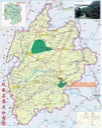
Fig. 13, Map of the Miao territory drawn in the Qing dynasty (note the frontier wall in the middle of the map) (may by Yan Ruyi in Miaofang beilan, adapted by Sheng Tianning in Qingdai zhongshuai zhizhan: Qian-Jia Miaomin qiyi yanjiu)

Fig. 5, The blockhouse and ruined barracks at Yongxingping (photo by Wang Bode)

Fig. 21, Gate of Huangsiqiang (photo by Wang Bode)
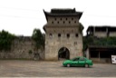
Fig. 18, Map of the frontier walls (Wu Xinfu, “Mingdai Xiang-Qian bian `Miaojiang’ `baoshao’ `bianqiang’ kao,” p. 97)
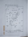
Fig. 19, Route of the Ming frontier wall (by Xiangxi Cultural Relics Administration Division)
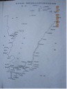
Fig., 29, Model of restored “Southern Great Wall”
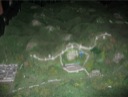
Fig. 32, Viewing the restored “Southern Great Wall” and Quanshiying through the loophole of the gatetower of Lahoaying camp-village

Fig. 34, Qiantan Miao Village

Fig. 38, Ma Jinhua (left) and Wu Chashan showing Miao costumes at Qiantan. Wu holds a special Miao pipe made by himself.

Fig. 47, The landscape of Quanshiying, upon which Wu Xinfu makes his point

|


